Flood Zone NYC is my thesis project and a year in the making. It was born from the belief that New York City was due for an eventual hundred year flood, and that it was important that citizens prepare themselves for upcoming storms. In fact, a report created by OEM found that 33% of residents in zone a were unaware of threats posed by a category 3 hurricane, while 50% of residents in no zone areas thought that they would be in immediate danger. Another report conducted by the army found that no zone residents were as likely to evacuate the city as zone a residents, the results of which would overburden the city's already stressed transportation system.
Hurricane Irene, therefore, proved to be an invaluable real world demonstration of city's already existing evacuation plans and notification systems. While the city was successful in getting their message out, they did not do so sufficiently on their own. For one, the city seemed to have preferred citizens attempt to find out if they lived in a flood zone by calling 311 rather than visiting the city's webtools. These tools, are in themselves overburdened with seemingly unnecessary steps, including a mapping solution, which I assume must interact with a database of every address in the city and whether or not they were in a flood zone. In fact, it would appear that what most circulated online were either the PDF map of the city's flood zones, or 3rd party solutions.
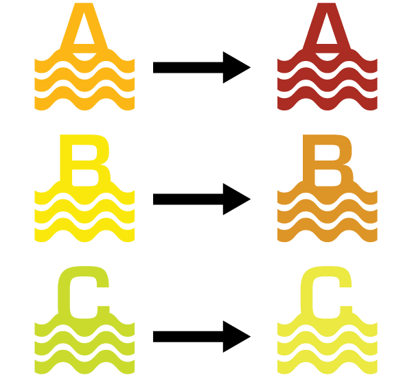
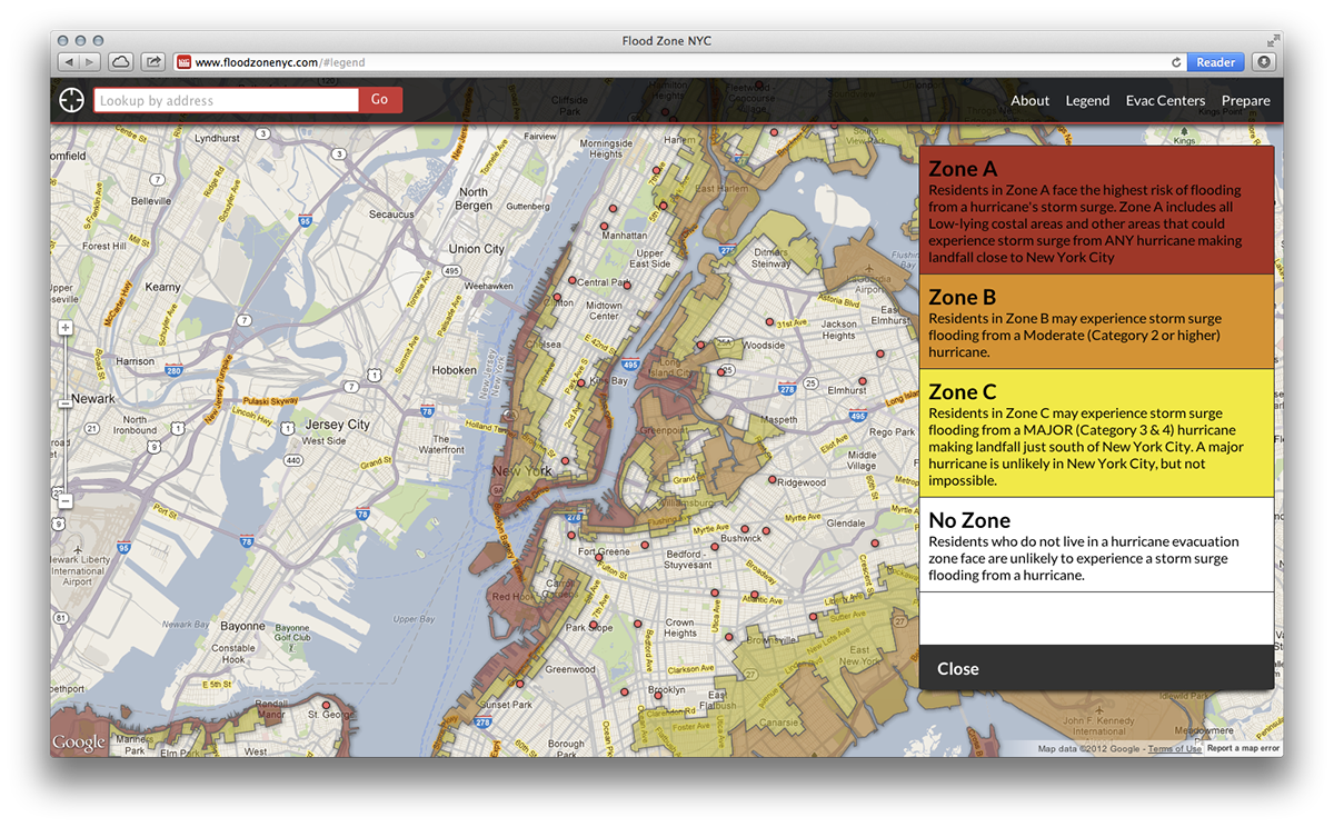
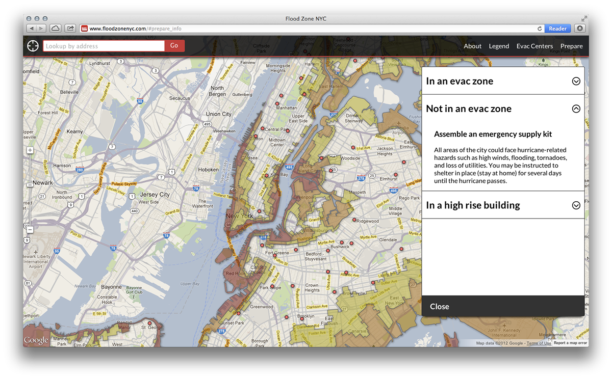
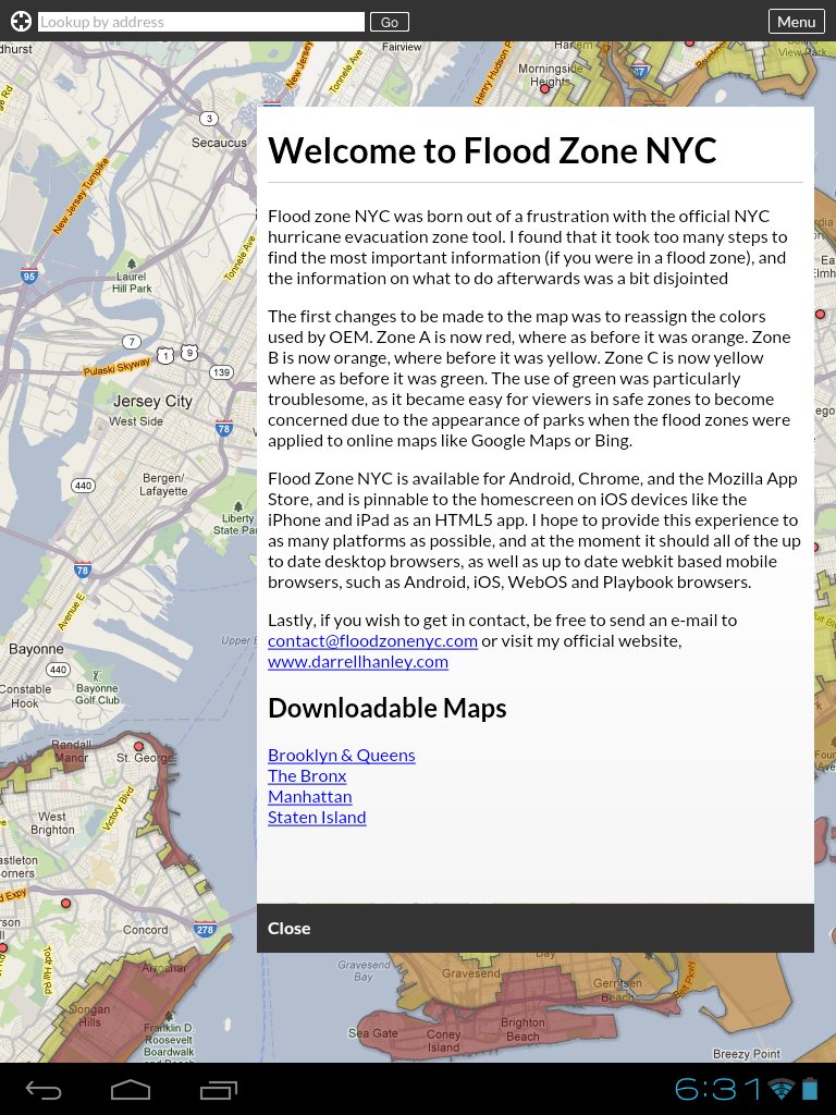
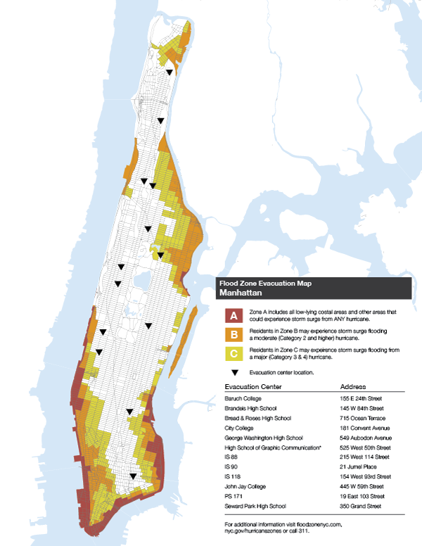
The first immediate problem was the color coding system that the city had chosen to designate their evacuation zones, a notable example being Zone C, which is officially designated with the color green, a color which one would usually associate with being safe. While it is unlikely that a storm capable of flooding Zone C will hit New York, it is important that the system used connote 'less danger' rather than 'more safe'.
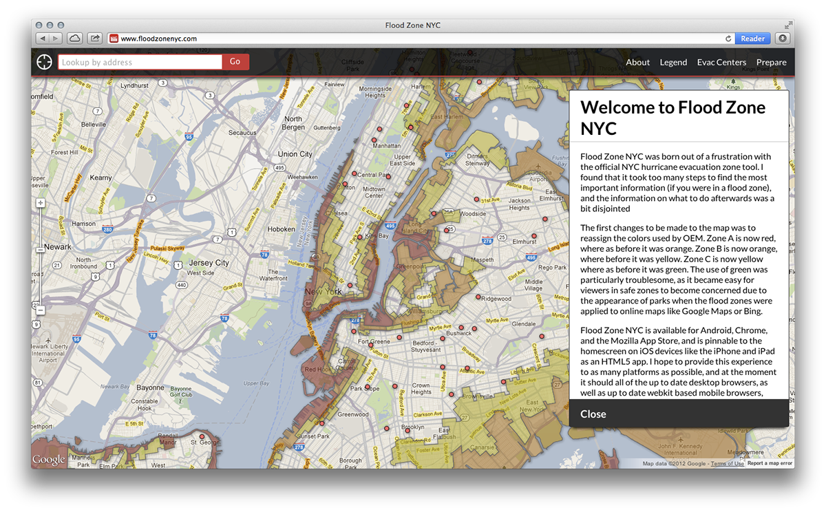
Unlike OEM, I decided to place my focus on online means of communication, believing that most people now learn news and share it on the internet and socials sites rather than the methods which were most effectively used by the city government during Irene (television news outlets).
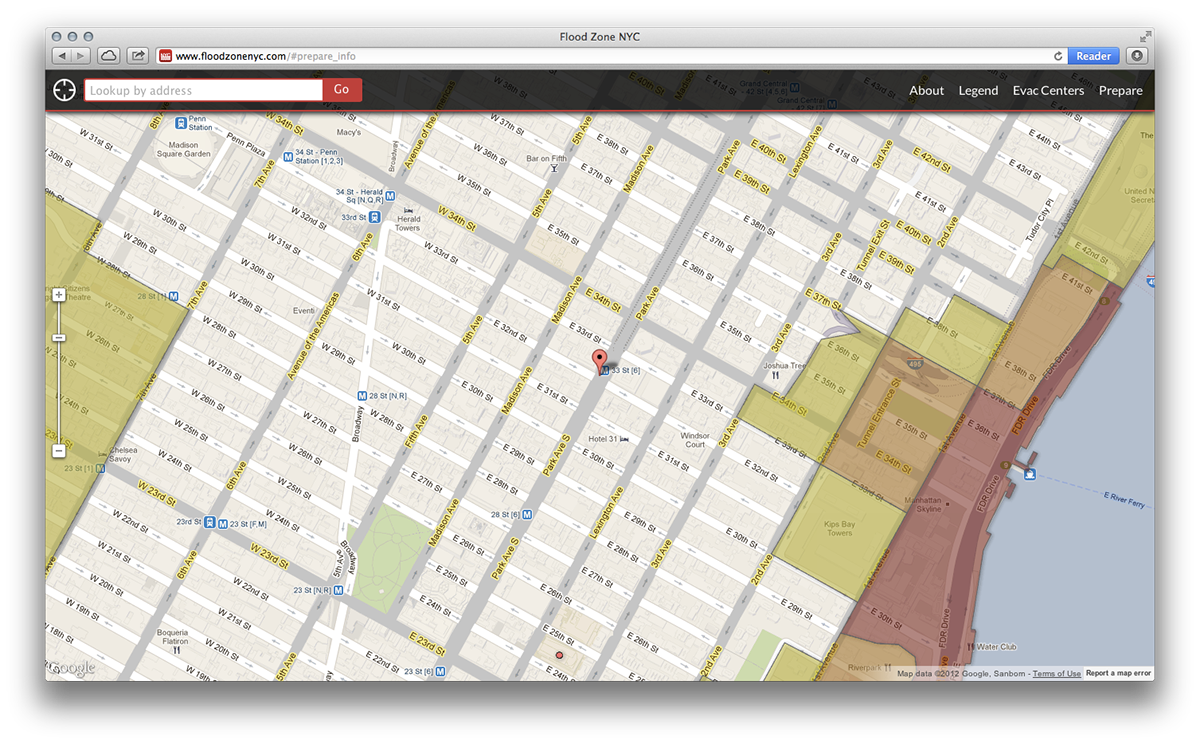
I used the Google Maps Javascript V3 API since it was the most adaptable and wider used API for generating maps. Doing so allowed me to support a wide variety of devices, as well as enable features such as GPS location to easily determine if the user was in a flood zone or not.
I used the Google Maps Javascript V3 API since it was the most adaptable and wider used API for generating maps. Doing so allowed me to support a wide variety of devices, as well as enable features such as GPS location to easily determine if the user was in a flood zone or not.
The website is available for all, however I've also made it available as an app for Google Chrome, and is available on the Chrome Web Store. It will also be added to Mozilla's equivalent for Firefox when it launches.
I chose to target iOS devices such as the iPhone and iPad with their pin to homescreen feature. This allowed me to support the platform without needing to submit for the Apple store, and simplified things such as updating, which could be pushed to users via the website rather than via application updates.

Android served as a rather particular challenge, as unlike iOS, it does not support a pin to homescreen method, meaning that web apps must be compiled for the Google Play store. So, I built a container application to run it. Flood Zone NYC for Android is now available on Google Play for free (requires Android 3.0+)

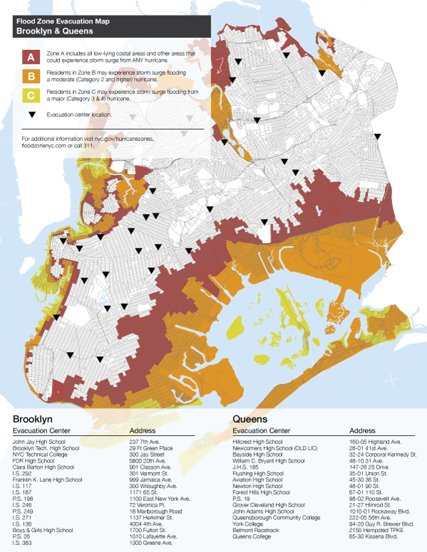
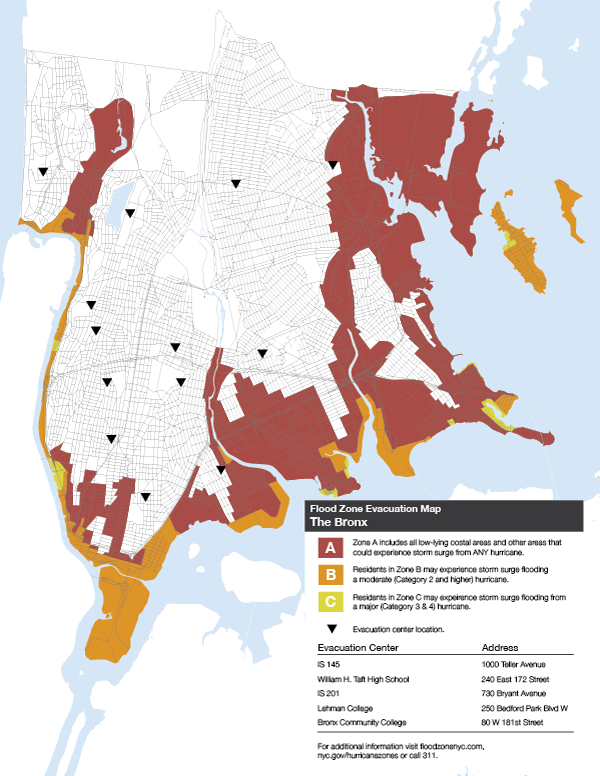
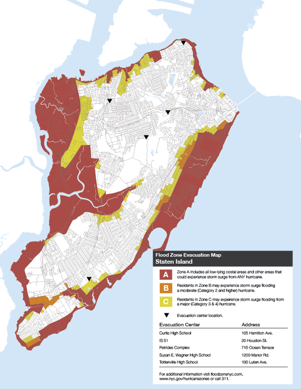
For those who wanted the ability to print maps, PDFs, adjusted from the ones originally created by the OEM were made available. I've changed the color scheme for the flood zones, the layouts, evacuation center signifiers, removed the daunting street titles, and separated the boroughs into four maps (Brooklyn and Queens sharing one). Because these are ment to be secondary to the website and apps, they are to be used for general approximation on if the user is in a flood zone or not, and to be able to verify with the website at a later time.
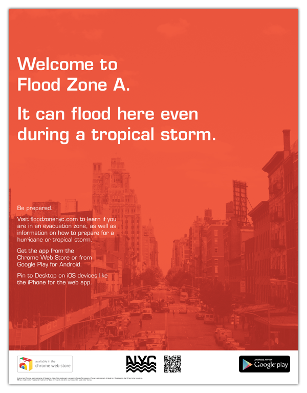
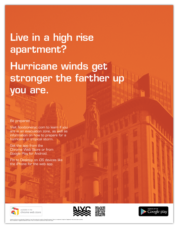
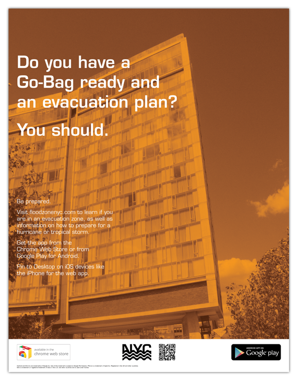
Lastly, promotional materials were made in order to spread awareness of the sites existence, a series of three in all, 17x22 posters, though created with the ability in mind to resize for subway and bus adverts.